

In the framework of the Kınık Höyük excavation project and in direct relationship with the initial geoarchaeological results obtained during the Bor Plain survey (eg: Basso & Gürel, 2009; d’Alfonso, 2010; Balatti & Balza, 2012; Gürel & Lermi, 2010), a palaeoenvironmental project started in 2013, which is based on an international collaboration between the Geology Engineering Department of the Niğde University (Resp: Doç. Dr. Ali Gürel) and the Laboratory of Physical Geography (LGP, UMR 8591) of the CNRS and Paris 1 Panthéon-Sorbonne University (Resp: Catherine Kuzucuoğlu, Senior Researcher at the CNRS). This palaeoenvironmental project receives logistic support from the Kınık Höyük excavation project. As part of the ArchéoMed project, it receives a financial support from MISTRALS/PalaeoMex programme (CNRS-INEE) and from AO Artemis (14C dating).
In central Anatolia, previous and on-going studies on the geographic, environment and climate evolution during the Holocene evidence results that possibly contrast with the drier Konya plain and the more humid Cappadocian highlands (an area globally limited by the Tuz Gölü/Aksaray fault-zone to the west, and the central Anatolian/ Sultansazlığı-Ecemiş fault-zone to the East). Today, a better knowledge and understanding of these Konya/Cappadocia geographic contrasts in the past and present (Gérard & Thissen, 2002; Kuzucuoğlu, 2002) needs the integration of environment into the study of cultural contrasts at various periods of the Holocene (characterization, successions and specific evolutions) between these two neighboring regions where pre-domestication started and developed together with the onset of the Holocene (Baird, 2011; Özbaşaran, 2011).
The project is particularly concerned with two periods:
- the increasingly humid Early Holocene, from 11000 cal BP (9000 BC) to 8000 cal BP (6000 BC) (Kuzucuoğlu, 2014). During this period local Pre-Pottery and Pottery Neolithic cultures (PPN to PN) experienced technical innovations such as pre-domestication/domestication practices, sedentarism in large agglomerated settlements, intensive exploitation and manufacturing of obsidian etc. (eg. Düring, 2011; Özbaşaran, 2011)
- the mid-Holocene period which was punctuated by several droughts interrupting more or less humid phases. Droughts lasted ca 2 centuries at the end of each millennium from 5200 cal BP (3200 BC) to the Iron Age in the 3rd mill. cal BP (1st mill. BC) (Kuzucuoğlu, 2011, 2012; Roberts et al., 2011). From 3200 BC to 1200 BC Bronze Age cultures and City States (EBA-MBA) f and the Hittite Empire (LBA) developed and expanded through the central plateaus and the Anatolian peninsula (Genz & Mielke, 2011; Düring, 2011).
A focus will be set upon the end of the 2nd mill. BC (end of the Hittite Empire), after which it is possible that a Hittite State in southern Cappadocia survived the fall of the capital Hattuša (Mora & d’Alfonso, 2012), thus possibly playing a role in the appearance of Neo-Hittite Kingdoms after the 2nd to 3rd centuries of the so-called “Dark Ages”, a period of general historical obscurity affecting many areas of the Eastern Mediterranean and Near East.
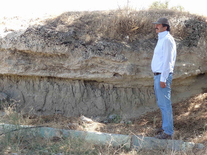
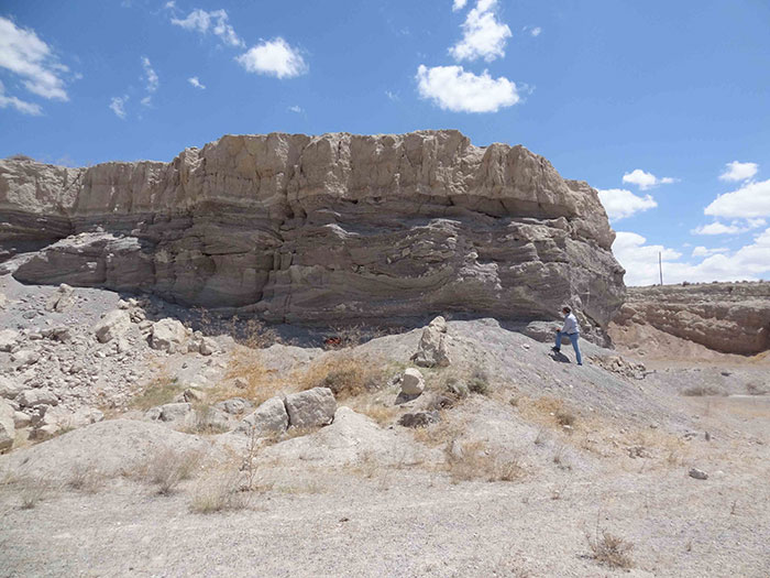
While also connected to the geomorphological and palaeoenvironmental studies performed at Aşıklı Höyük (PPN) and at Tepecik-Çiftlik (PN) excavation sites, the palaeoenvironmental project performed in the framework of the Kınık Höyük archaeological research project focuses on the South-Cappadocian lowlands which are constitute the watershed of the Melendiz dağ volcanic massif, the Keçiboyduran volcano and the Hasan dag volcano. These lowlands – where Kınık Höyük is located – are composed of a high variety of geological formations and geomorphological landscapes. This patchwork is geographically organized NE-SW towards the Ereğli plain which is the eastern extension of the broader Konya plain. This general organization results from a very interesting geomorphological evolution during the Holocene, which has most evidently archived environment and climatic changes. Indeed, these semi-arid lowlands have been very sensitive to all climatic variations and changes, which affected primarily the water resources and the hydrological dynamics and systems. A GIS and satellite imagery study (Cetoute, 2014) shows that the lowlands are constrained southwards and northwards by the construction of Holocene alluvial fans fringing the Melendiz dağ (north, in the Kınık Höyük area) and the Taurus (south, in the Ereğli town area). In this central part between the fans, both lake and river systems succeeded, wet or dry, in responding to humidity variability.
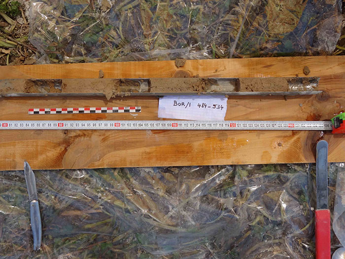
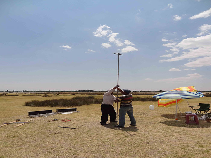
Since 2013, in the transition area between these two sets of alluvial fans, the project has initiated a coring exploration of sediment sequences selected in closed depressions which may have been occupied in the past by lakes or marshes (Kuzucuoğlu & Gürel, 2013), with the objectives, among others, of:
- verifying the existence (?) of a lake near Kınık Höyük during the 2nd mill. BC, as stated by a Hittite textual document (information communicated by L. d’Alfonso);
- completing to the Late Glacial and Holocene palaeoenvironmental reconstruction obtained previously in the Konya plain (Kuzucuoğlu et al., 1997; 1998, 1999a, 1999b, 2002; Fontugne et al., 1999; Boyer et al., 2006) and the Ereğli plain (Bottema and Woldring, 1984), to be compared with results obtained in northern Cappadocia published by Roberts et al. (2001) (Eski Acıgöl, near Nevşehir) and to be soon published by another team directed by N. Roberts (Nar Gölü, near Nenezi dağ).
References
d’Alfonso L., 2010. Geo-Archaeological Survey in Northern Tyanitis and the Ancient History of Southern Cappadocia. In: L. d’Alfonso, M.E. Balza, C. Mora (eds.), Geo-archaeological Activities in Southern Cappadocia, Pavia Universita, 27-55.
Baird D., 2011. Pınarbaşı: From Epi-Paleolithic camp-site to sedentarising village in Central Anatolia. In: N. Başgelen, P.I. Kuniholm, M. Özdoğan (eds.), The Neolithic in Turkey, Central Anatolia and Mediterranean, Vol. 3, Arkeopera/Istanbul, 2012, 181-218.
Balatti S. & Balza M.E., 2012. Kınık-Hoyuk and Southern Cappadocia (Turkey): Geo-Archaeological Activities, Landscapes and Social Spaces. In: R. Hofmann, F.K. Moetz, J. Müller (eds), Proceedings of the International Workshop “Socio-Environmental Dynamics over the Last 12,000 Years: The Creation of Landscapes II, Vol. 3, Verlag Dr. Rudolf Habelt GmbH, Bonn.
Basso E. & Gurel A., 2009. Notes on the sedimentary sequence of Kınık Hoyuk. Appendix to L. d’Alfonso and C.Mora, “Viaggi anatolici” dell’Universita di Pavia”, in: Rapporto preliminare della terza campagna di ricognizione archeological nella Tyanitide settentrionale (2008), Athenaeum, 97, 645-655.
Bottema S. & Woldring H., 1984. Late Quaternary vegetation and climate of south-western Turkey, Palaeohistoria, 26, 123-149.
Boyer P., Roberts N., Baird D., 2006. Holocene environment and settlement on the Carsamba alluvial fan, south-central Turkey: Integrating geoarchaeology and archaeological field survey. Geoarchaeology, 21 675-698.
Cetoute J., 2014. A GIS and satellite imagery-based study of the Bor plain between Melendiz dağ and Ereğli plain. Graduation Thesis for Professional Training in Geomatics. Paris 1 Panthéon-Sorbonne Univ. Unpublished.
Düring B.S., 2011. The Prehistory of Asia Minor. From Complex Hunter-Gatherers to Early Urban Societies. Cambridge University Press, 360 pp.
Fontugne M., Kuzucuoğlu C., Karabıyıkoğlu M., Hatté C., Pastre J-F.., 1999. From Pleniglacial to Holocene: a 14C chronostratigraphy of environmental changes in the Konya Plain, Turkey. Quaternary Science Reviews, 18/2, 573–591.
Genz, H. & Mielke, D.P. 2011. Insights into Hittite history and archaeology. COLLOQUIA ANTIQUA, 2, Peeters Publ., 340 pp.
Gérard F. & Thissen (eds) L., 2002. The Neolithic of central Anatolia, Istanbul, BIAA-IFEA-LANED, Ege Yayinlari,n 33-58.
Gürel A. and Lermi A., 2010. Pleistocene-Holocene Fills of the Bor-Ereğli Plain (Central Anatolia): Recent Geo-Archaeological Contributions. In: L. d’Alfonso, M.E. Balza, C. Mora (eds.), Geo-archaeological Activities in Southern Cappadocia, Pavia Universita, 55–68.
Kuzucuoğlu C., Karabıyıkoğlu M.,,Fontugne, M., Pastre J-F., Ercan T., 1997. Environmental changes in Holocene lacustrine sequences from Karapınar in the Konya Plain (Turkey). In: N. Dalfes, G. Kukla, H. Weiss (eds), Third Millenium BC Climate Change and Old World Collapse, NATO ASI Series, 149,.451-163.
Kuzucuoğlu C., Parish R., Karabıyıkoğlu M., 1998. The dune systems of the Konya Plain (Turkey). Their relation to the environment changes in Central Anatolia during Late Pleistocene and Holocene. Geomorphology, 23, 257-271.
Kuzucuoğlu C., Bertaux J., Black S., Denèfle M., Fontugne M., Karabıyıkoğlu M., Kashima K., Limondin-Lozouet N., Mouralis M., Orth P., 1999a. Reconstruction of climate changes during the Late Pleistocene, based on sediment records from the Konya Basin (Central Anatolia, Turkey). Geology, 34, 175–198.
Kuzucuoğlu C., Fontugne M., Karabıyıkoğlu M., Hatté C., 1999b. Evolution de l'environnement dans la plaine de Konya (Turquie) pendant l'Holocène. In: M. Otte (ed.), Anatolian Prehistory. At the Crossroads of Two Worlds, Liège Univ., 605-624.
Kuzucuoğlu C., 2002. The environmental frame in Central Anatolia from the 9th to 6th millennia BC. In: F. Gerard & L. Thissen (eds), The Neolithic of central Anatolia, Istanbul, BIAA-IFEA-LANED, Ege Yayinlari, 33-58.
Kuzucuoğlu C., Dörfler W., Kunesch, S., Goupille, F., 2011. Mid-Holocene climate change in central Turkey : the Tecer lake record. The Holocene, 21, 1, 173-188.
Kuzucuoğlu C., 2012. Le rôle du climat dans les changements culturels, du Vè au 1er millénaire avant notre ère, en Méditerranée orientale. In: J-F. Berger (Ed.), Des climats et des hommes, Ed. La Découverte, 239-256.
Kuzucuoğlu C. & Gürel A., 2013. Year 2013 Geomorphology Report to the Kinik Höyük Project. Unpublished.
Kuzucuoğlu C., 2014. The Neolithic in Anatolia at the regional scale: Some issues concerning chronology and environmental contexts. In: G. Arnaud-Fassetta & N. Carcaud (eds.), French geoarchaeology in the 21st century, CNRS Editions, Paris.
Mora C. & d’Alfonso L., 2012. Anatolia after the end of the Hittite Empire. New evidence from southern Cappadocia. ORIGINI Serie V, X-XX, 385-399.
Özbaşaran M., 2011. The Neolithic on the Plateau. In: S.R. Steadman, G. McMahon (eds.), Ancient Anatolia 10,000-323 B.C.E., The Oxford Handbook of Ancient Anatolia, Oxford University Press, 99-124.
Roberts, N., Reed, J., Leng, M., Kuzucuoğlu, C., Fontugne, M., Bertaux J., Woldring, H., Bottema, S., Black, S., Hunt, E., Karabiyikoglu, M., 2001. The tempo of Holocene climatic change in the Eastern Mediterranean region : A new high-resolution crater-lake sediment data from central Turkey. The Holocene. 11, 6, 721-736.
Roberts N., Eastwood W., Kuzucuoğlu, C., Fiorentino G., Caracuta V., 2011. Climatic, vegetation and cultural change in the eastern Mediterranean during the mid-Holocene environmental transition. The Holocene,.21, 1, 147-162.